Pollution mapping becomes more useful when technology and local knowledge strengthen each other. A coastal monitoring pilot in southern Chile tested that idea in Chiloé and Aysén.
SalmonChile, Këtrawa, Paz Recycling, and Eyesea completed the pilot after field visits, data calibration, and satellite analysis across selected coastal areas. The work grew from the Observatorio de Playas innovation challenge, which looked for better ways to support waste monitoring and cleanup planning in Patagonia.
Connecting observations from land and space
Local teams were trained to use the Eyesea platform. They recorded where pollution was found, what kind of waste was present, and how much was observed at each sample point. Findings were photographed and given precise locations.
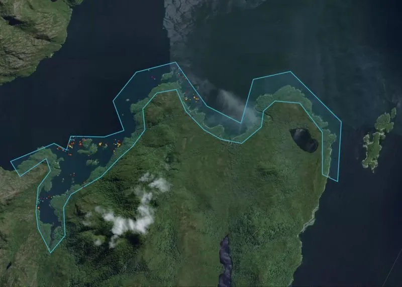
Satellite imagery provided another view of the same areas. Field observations were used to calibrate the analysis and help identify places where waste was concentrated. This produced maps that could support decisions about where more monitoring or cleanup work may be needed.
This matters because neither source of information is enough on its own. Satellite analysis can cover wide and difficult coastal areas. People working on the ground can confirm what is present, record details, and add local context. Bringing both together creates a more useful picture of pollution.
What the pilot established
The pilot established a working process that joined mobile reporting, field calibration, satellite imagery, artificial intelligence, and pollution maps. Published coverage says the final work recommended expanding monitoring and including more community participation.
That is the correct boundary of the result. This was a completed pilot, not proof of full regional coverage or a measured cleanup outcome. Wider figures reported for SalmonChile cleanup activity in 2024 describe a separate program and are not Eyesea results.
What comes next
The next question is how this process can support regular monitoring across more remote coastal areas. Any expansion should keep local teams at the centre. It should also use field records to test satellite interpretation and publish clear methods for turning observations into decisions.
For Eyesea, the pilot shows the practical value of connecting a report made on the coast with a wider view from space.
Better pollution data begins with seeing the same place from more than one perspective.
Sources
-
SalmonChile, pilot completion report, 6 February 2025. Primary partner account of the pilot, participating organisations, methods, and next steps.
-
Paz Recycling, pilot account, 1 February 2025. Field partner account of the work in southern Chile.
-
Diario Acuícola, 6 February 2025. Regional reporting on field visits, local training, georeferenced observations, satellite calibration, and pollution maps.
-
InfoSalmon, 6 February 2025. Chilean aquaculture coverage of the same pilot.
-
LitoralPress print clipping, 10 February 2025. Print record of the announcement and participating organisations.
-
Revista AQUA feature, 24 April 2025. Later trade feature describing the roles of satellite analysis and field work.